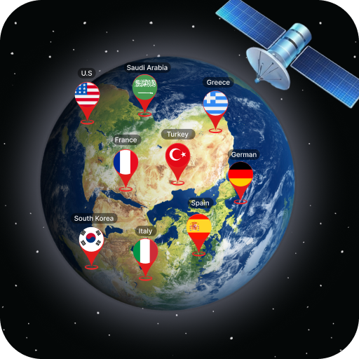
Earth Map Satellite Live View
Discover Earth with Earth Map Satellite Live View, the leading travel & navigation app. Free now and explore the world from your device! Turn your device into a globe.
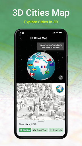
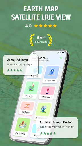
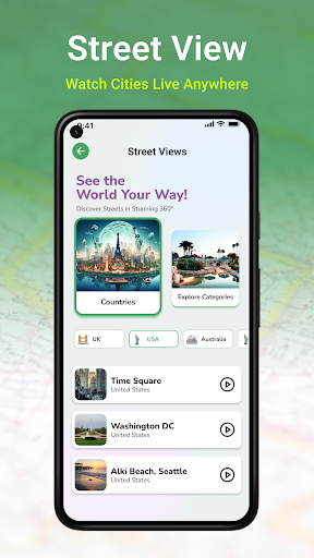
Screenshots
Download Earth Map Satellite Live View
You are going to be redirected to the official website to finish the download when you click the button below.
About Earth Map Satellite Live View
Earth Map Satellite Live View is a versatile mobile app designed for navigation and exploration enthusiasts. It offers detailed satellite imagery and real-time Earth views, allowing users to virtually explore any location around the world. As an intuitive Android app, it provides an engaging app experience with its comprehensive map features and live satellite updates, making it a valuable app-based solution for travel planning, education, and geographic insight.
Overview
Core Features
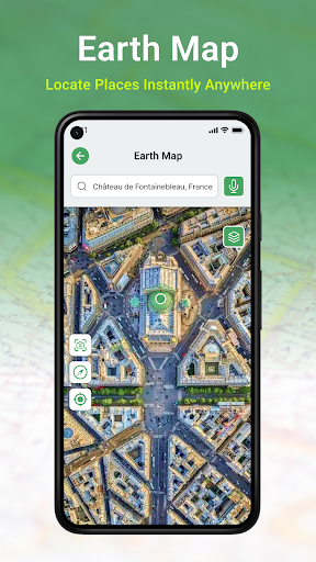
- High-resolution satellite imagery that provides detailed Earth views from space, ideal for exploration.
- Real-time live view updates allow users to observe current weather conditions or geographical changes instantly.
- Offline mode enables access to saved maps and satellite images without an internet connection, enhancing convenience.
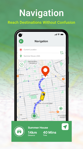
- Intuitive navigation features help users easily explore different locations and navigate using satellite overlays.
- Advanced app features include route plotting and distance measurement for accurate mapping and planning.
- The app offers seamless integration with device GPS, ensuring precise location tracking within the app experience.
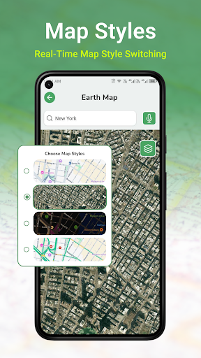
- Customization options allow users to select different map types and satellite layers for tailored viewing experiences.
Who This App Is For
This mobile app is perfect for outdoor enthusiasts, travel lovers, and professionals like geographers or urban planners who need detailed earth visuals and navigation tools.
Whether you're exploring new places, planning routes, or conducting fieldwork, this app-based solution provides a reliable way to view satellite imagery and access map features on your Android device.
Why Choose This App
This Android app stands out for its sharp satellite images and real-time update capabilities, offering an enriching app experience for users seeking detailed Earth views.
It delivers a user-friendly interface combined with powerful app features, making it a trustworthy choice for those needing accurate maps and satellite data for personal or professional use.
Features
Discover the World with Live Satellite Imagery for Educational Enthusiasts
High-Quality Real-Time Earth Views for Engaging Virtual Exploration
Zoom, Pan, and Switch Perspectives to Explore Details and Landscapes
Navigate with Voice-Guided Directions for Seamless Virtual Journeys
Utilize Compass and Pedometer Tools for Interactive Learning Experience
Access Street and Satellite Views for Comprehensive Visualizations
Experience Dynamic HD Earth Maps for Authentic Real-Time Navigation
Plan Trips and Discover Places with Interactive Location Search
Pros
- +High-resolution live satellite imageryUsers can view detailed satellite images of any location worldwide in real-time, enhancing accuracy for studies or casual exploration.
- +User-friendly interfaceThe app offers an intuitive, easy-to-navigate design suitable for both professionals and casual users.
- +Real-time updatesImages are refreshed frequently, providing current views of geographic changes or event monitoring.
- +Global coverageSupports viewing from remote areas and urban zones alike, making it versatile for various needs.
- +Additional mapping toolsIncludes features like zoom, layering, and measurement tools to enhance user experience.
Cons
- -Limited free access for high-resolution imagesHigher quality images often require a subscription, which might restrict casual users.medium
- -Occasional lag or slow loading times in certain regionsSome users report delays due to server load or connectivity issues; official server improvements are anticipated.medium
- -Battery consumption can be high during extensive usageProlonged viewing drains device power quickly; users can reduce usage duration or lower resolution to mitigate this.low
- -Limited historical imagery accessThe app mainly focuses on live views and offers little for accessing past satellite images, but future updates may include timeline features.low
- -Some features require a stable internet connectionOffline viewing options are minimal; improvements like offline caching are expected in upcoming updates.low
FAQ
How do I get started with Earth Map Satellite Live View?
Getting started with Earth Map Satellite Live View is really straightforward. Once you install this mobile app on your device, you can easily access its features for live satellite views of the Earth. The app provides an intuitive interface, making navigation simple even for first-time users.
Whether you're using an Android app or looking for a launcher app that offers maps and navigation capabilities, Earth Map Satellite Live View offers a smooth app experience. It's designed to ensure users can quickly explore and enjoy detailed satellite imagery without hassle.
Is Earth Map Satellite Live View safe to use?
Yes, Earth Map Satellite Live View is a safe and secure app that respects user privacy. Developed by experienced professionals, the app meets standard safety protocols to protect your data while providing high-quality map features.
You can rely on this app's trustworthiness for regular use on your Android device, knowing it offers accurate satellite imagery and a secure app experience for exploring the world from your phone.
What are the main features of Earth Map Satellite Live View?
This app offers a range of impressive features, including real-time satellite views, detailed mapping, and zoom options. Users love how it combines satellite imagery with navigation tools, making it ideal for exploring remote areas or planning trips.
With app features such as live earth views and precise location tracking, Earth Map Satellite Live View stands out as a top choice in the maps & navigation category. Its app features help you enjoy a rich app experience whether you're on an Android device or seeking a versatile launcher app for maps.
Can I use Earth Map Satellite Live View offline?
While the main app features primarily require an internet connection, some map functionalities can be used offline after you've downloaded specific satellite data. This makes it convenient to explore areas without consistent internet access.
Keep in mind that for the best app experience and to access all features, a stable connection is recommended. This app based solution is optimized to provide detailed satellite imagery quickly and efficiently on your Android device.
How does Earth Map Satellite Live View compare to other mapping apps?
Earth Map Satellite Live View offers a unique app experience with its real-time satellite imagery and user-friendly interface. Unlike some other mapping apps, it focuses heavily on live satellite views, which can be especially useful for outdoor activities or geographic understanding.
Its app features are designed to deliver detailed visuals without the need for complex navigation, making it a practical choice among launcher apps and navigation tools. It's a trusted app-based solution for users who want high-quality satellite views right on their Android device.
Is Earth Map Satellite Live View suitable for all devices?
This Android app is optimized for most modern smartphones and tablets, providing a seamless app experience across different device types. It offers high-resolution satellite imagery and smooth navigation features, enhancing usability.
If you're looking for a reliable app for maps and navigation, Earth Map Satellite Live View works well on various Android devices, ensuring you get detailed earth views, whether you're exploring urban areas or remote locations.